Municipality Šempeter-Vrtojba
Trg Ivana Roba 3a
5290 Šempeter pri Gorici
T: +386 (0)5 335 10 00
F: +386 (0)5 335 10 07
E: info@sempeter-vrtojba.si
Official Hours:
Monday and Friday:
8.00 a.m.-12.00 a.m.
Wednesday:
8.00 a.m.-12.00 a.m. and
2.00 p.m.-4.30 p.m.
VAT no.: SI 44857390
Registration number: 1358227

Trg Ivana Roba 3a
5290 Šempeter pri Gorici
T: +386 (0)5 335 10 00
F: +386 (0)5 335 10 07
E: info@sempeter-vrtojba.si
Official Hours:
Monday and Friday:
8.00 a.m.-12.00 a.m.
Wednesday:
8.00 a.m.-12.00 a.m. and
2.00 p.m.-4.30 p.m.
VAT no.: SI 44857390
Registration number: 1358227
The Settlements
The municipality Šempeter-Vrtojba is part of the Gorizia region. As the name suggests these two towns co-exist with each other. Interestingly, they are stretching over a fertile field that gives a rich harvest. Due to proximity to the Adriatic Sea there is an early production of vegetables, fruits and flowers.
Šempeter pri Gorici
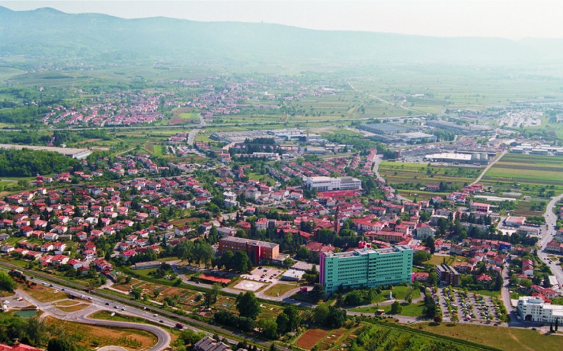 Šempeter pri Gorici is a town in Slovenia and the heart of the municipality Šempeter-Vrtojba. It is situated on an important crossroads between Nova Gorica and the Soča Valley, and the Vipava Valley and Italy.
The town arose as a farming settlement on the right bank of the Vrtojbica stream. It began to develop quickly soon after the end of World War Two, as it became the economic and administrative centre after Gorica came under Italian rule. This role was later taken over by the newly established town of Nova Gorica. However, Šempeter still remains the second most important centre for employment in the Goriška Region.
Vrtojba
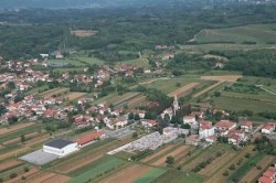
Vrtojba lies south of Nova Gorica on the fertile Goriška Plain in Western Slovenia, right on the Italian border. It is a typical roadside village, extending over almost three kilometres and stretching from north to south along the main road, which connects the Goriška Region to the Karst region. The Vrtojbica stream runs through the village and flows south-west into the river Vipava. The settlement has evolved where the gravelly soil of the Vrtojba fields and the clayey flysch soil of the Vrtojba-Bilje knolls meet. The village's highest point, 83 m.a.s.l., is on these vineyard-covered knolls. In the south of the village, towards Miren, there are several large gravel pits.
After World War Two this former farming settlement, known mainly for its cultivation of early vegetables and crops, developed into a working-class farming village. It could be said that the ever quickening disappearance of the latter is giving way to the fast development of many trades and crafts. With a lively growth in housing construction and a sharp rise in the number of inhabitants, Vrtojba is becoming a southern suburb of the Nova Gorica agglomeration.
Geographical Information
Elevation - Šempeter pri Gorici: 72 m
Geographical location Šempeter pri Gorici:
45°55'42,16'N, 13°38'16,73'E
Najdi.si; Geopedia.si
Elevation - Vrtojba: 60,9 m
Geographical location Vrtojba:
45°54'32,12'N, 13°38'11,02'E
Najdi.si; Geopedia.si